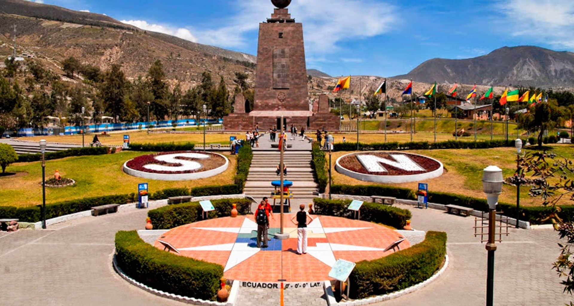
Ecuador takes its name from the equatorial line, which crosses the Andes between Quito and Otavalo. Sitting on the equator means the temperature hardly changes through the year: in Quito the monthly average moves by less than 2°F. It does not mean the weather is the same everywhere. Altitude sets the temperature, so Quito, high in the Andes, averages about 20°F cooler than Guayaquil on the coast.
Ecuador has seasons. They are wet and dry, and each region keeps its own calendar. Take July: the driest month in Quito, less than one rainy day on average in Guayaquil, and still 11 inches (278 mm) of rain at Nuevo Rocafuerte in the Amazon. The useful question is not when, but where.
Average temperatures and rainfall are climate normals from INAMHI, Ecuador’s national meteorology and hydrology institute, as reported to the World Meteorological Organization: 1981–2010 for Quito, Puyo and Nuevo Rocafuerte, 1961–1990 for Guayaquil’s airport. INAMHI publishes no daytime highs for Guayaquil or Quito, so those two are our own averages of NOAA’s daily airport records (Guayaquil 1991–2020, Quito’s old airport 1991–2012), a guide rather than an official normal. Ranges are the spread of the monthly averages, in Fahrenheit with Celsius in parentheses.
| City (station) | Altitude | Average temperature | Typical high | Rain per year | Wettest months | Driest months |
|---|---|---|---|---|---|---|
| Guayaquil, coast (airport) | 30 ft (9 m) | 76–81°F (24–27°C) | 84–89°F (29–31°C) | 40 in (1,026 mm) | January–March | July–November |
| Nuevo Rocafuerte, Amazon lowlands | 610 ft (185 m) | 76–79°F (25–26°C) | 91–95°F (33–35°C) | 112 in (2,850 mm) | April–June | November–January |
| Puyo, Amazon foothills | 3,140 ft (956 m) | 68–71°F (20–22°C) | 83–87°F (29–31°C) | 181 in (4,604 mm) | April–June | August |
| Quito, Andes (INAMHI Iñaquito) | 9,150 ft (2,789 m) | 58–60°F (15°C) | 66–69°F (19–20°C) | 43 in (1,092 mm) | March–April, October–November | June–August |
Read across a row and the month barely moves the thermometer: the coast and the Amazon are warm all year, Quito mild. Read down, from the coast to the capital, and altitude does nearly all the work. For which months suit which trip, see the best time to visit Ecuador.

By day the Andes Mountains are cool, not cold. Quito’s typical high sits at 66–69°F (19–20°C) in every month and its typical low at 49–50°F (9–10°C), so the old rule that temperatures here rarely pass 75°F (24°C) holds in the capital. It does not hold in the valleys. La Tola, a station in the valley east of Quito at 8,140 feet (2,480 m), averages highs of 78–80°F (25–27°C) all year.
Go higher and the nights are what you notice. Otavalo, at 8,370 feet (2,550 m), averages lows of 38–42°F (3–6°C), coldest in the dry months of July to September. At Izobamba, at 10,030 feet (3,058 m), the average low is 36–39°F (2–4°C).
Rain decides the season here, not heat. Quito gets 43 inches (1,092 mm) a year in two wetter spells, February to May, peaking in April at 6.7 inches (171 mm), and October to November. June to September is dry: July brings less than an inch (21 mm), and July and August get about 60 percent more sunshine than March. The wet months are wetter, not colder. That sunny stretch belongs to the Andes, not the whole country, and it suits a Quito tour or a trip south along the Avenue of the Volcanoes to Cuenca.
The coast runs on a single cycle. At Guayaquil’s airport the rain falls from January to April and peaks in March, at 9.9 inches (252 mm) over about 15 rainy days. From June to November it is close to rainless: August, September and October together average less than a quarter of an inch (6 mm).
The wet season is also the hot one. Guayaquil’s monthly average peaks at 81°F (27°C) in March and April and drops to 76°F (24°C) in August. So the old line about warm temperatures and periodic showers from December to April holds, though December itself averages only about two rainy days. The other half of the year is drier and a few degrees cooler. The Guayaquil to Quito railway climbs from this heat into the Andes, so one trip crosses both climates.

In the eastern Amazon region, the Oriente, rain falls in every month, not most of them. At Nuevo Rocafuerte, on the Napo River at the border with Peru, 112 inches (2,850 mm) fall on about 192 days a year, and no month gets less than 5.4 inches (137 mm). The wettest stretch is April to June.
The old advice that September to December is driest does not match the records. At Nuevo Rocafuerte the least rain falls from November to January; at Puyo, in the foothills, it is August. Either way the choice is between wet and very wet. Puyo gets 181 inches (4,604 mm) on about 265 days, with highs of 83–87°F (29–31°C) and nights of 55–59°F (13–15°C). Down at Nuevo Rocafuerte, highs run 91–95°F (33–35°C) and the relative humidity averages 85–89%.
Napo Wildlife Center, in Yasuní National Park and reached by boat along the Napo from Coca, lies upstream on the same river. Our Ecuador cruises include Amazon river trips, and the Amazon rainforest has its own weather guide.
The Galápagos Islands make for a pleasant visit year-round, in two halves. At San Cristóbal, January to May is warm, with monthly averages of 78–80°F (26–27°C), and January to April is the wet half, with about 4 inches (105 mm) in each of February and March. From June to December it turns cooler, 71–72°F (22°C) in August to October, and August to November each get half an inch (13 mm) of rain or less. The islands have their own Galápagos weather guide, and a Quito and Galápagos cruise pairs them with the cool capital.
The averages hide some wild years. Near the end of each year the ocean warms along the coasts of Ecuador and northern Peru, and in El Niño years, NOAA’s Climate Prediction Center notes, the west coast of tropical South America turns wetter than normal. In the 1982–83 El Niño, according to a NOAA report, up to 100 inches (2,540 mm) of rain fell in six months in Ecuador and northern Peru. Guayaquil’s wettest March between 1961 and 1990 brought 33 inches (833 mm), more than three times the normal. If your trip touches the coast in an El Niño year, expect a heavier wet season and leave some slack in the plan.
Pack for two climates at once. In Quito and the highlands, a light jacket covers the day and a warm layer the night, when average lows of 36–50°F (2–10°C) are typical at the Andean stations above. For the coast and the Amazon, bring light clothes that dry fast, and for the Andean wet spells and the Oriente, a rain jacket. The rest is on our Ecuador packing list.
If your route crosses the coast, the Andes and the Amazon, share your dates when you ask about a custom Ecuador trip, so each region’s rain calendar shapes the order of the route from the start.