Venezuela has a Caribbean climate on the coast, hot all year and on Isla Margarita surprisingly dry. Inland is not automatically more temperate, though. The lowland interior is the hottest part of the country, with average highs near 98°F (37°C) at San Fernando de Apure, on the plains of Los Llanos, in March. What cools Venezuela is altitude, and above Mérida the high mountain ranges of the Andes reach a near-alpine climate.
In most of the country, temperatures barely move through the year. Rain is what changes, and rain decides the season.
These are official climate normals from Venezuela’s weather stations, as reported to the World Meteorological Organization and published by NOAA. Temperatures are 1991–2020 normals for every station, shown as the range of the monthly averages. Rainfall mixes two periods, marked in each row: 1991–2020 for Porlamar and Mérida, 1961–1990 for San Fernando de Apure, Caracas and Santa Elena de Uairén. The newer rain records for those three contain impossible months, such as 1,186 mm (47 in) in a single month at Caracas, against a long-term average of 36 inches (917 mm) a year. Rainfall figures in the sections below use the same periods.
| City (station) | Altitude | Typical high | Typical low | Rain per year | Wettest months | Driest months |
|---|---|---|---|---|---|---|
| Porlamar, Isla Margarita | 50 ft (16 m) | 87–92°F (31–33°C) | 73–78°F (23–26°C) | 21 in (527 mm), 1991–2020 | July–August | February–May |
| San Fernando de Apure, Los Llanos | 170 ft (52 m) | 87–98°F (31–37°C) | 73–77°F (23–25°C) | 53 in (1,350 mm), 1961–1990 | June–August | December–March |
| Caracas (La Carlota) | 2,790 ft (850 m) | 81–85°F (27–29°C) | 63–70°F (17–21°C) | 36 in (917 mm), 1961–1990 | June–October | January–March |
| Santa Elena de Uairén, Gran Sabana | 2,940 ft (897 m) | 78–84°F (25–29°C) | 64–66°F (18–19°C) | 67 in (1,692 mm), 1961–1990 | May–July | January–February |
| Mérida, Andes | 5,250 ft (1,599 m) | 79–81°F (26–27°C) | 59–63°F (15–17°C) | 60 in (1,536 mm), 1991–2020 | April–May, September–November | December–February |
Read across a row and, outside Los Llanos, the month hardly matters. Read down the table and the hottest station is San Fernando de Apure, low and inland, not the beach.

Caracas sits in a valley at 2,790 feet (850 m), with highs of 81–85°F (27–29°C) and nights of 63–70°F (17–21°C), coolest in January. The Maiquetía airport station on the coast below, at 230 feet (71 m), averages highs about 6°F warmer. Same months, nearly the same latitude. The difference is altitude.
Mérida, at 5,250 feet (1,599 m), is milder again, with nights of 59–63°F (15–17°C). Above the city the Andes climb into near-alpine country. They held Venezuela’s last glacier, the Humboldt, or La Corona, until NASA reported in 2024 that it had shrunk from 450 hectares to about two, too small to count as a glacier. Real cold in Venezuela lives up there, far above the cities. Down in the Gran Sabana, Santa Elena de Uairén’s 2,940 feet (897 m) is enough for steady nights of 64–66°F (18–19°C).

Venezuela has no summer or winter in the North American sense. INAMEH, the national meteorology and hydrology institute, describes a dry season from December to March and a rainy season from April to November. Each region bends those months a little. For when to go, see the best time to visit Venezuela.
Caracas follows the national pattern. January to March bring about half an inch (12–16 mm) a month, June to October 4.5 to 5.5 inches (114–139 mm). The rain barely cools the city: May has its warmest average high, 85°F (29°C). Mérida has two rainy peaks instead, April–May and September–November, with October near 8 inches (205 mm) and January only 1.3 inches (32 mm).
The plains swing hard. At San Fernando de Apure, December to March bring under half an inch (1–10 mm) a month, then June to August bring 9.6 to 10.9 inches (243–276 mm) each. Heat builds through the dry months to a 98°F (37°C) average high in March. July, deep in the rains, is the coolest month at 87°F (31°C). Here the rain brings the relief.
The southeast is wetter. Santa Elena de Uairén, where our Mount Roraima trek starts, gets 67 inches (1,692 mm) a year, wettest May to July. Even February, its driest month, averages 2.2 inches (57 mm).
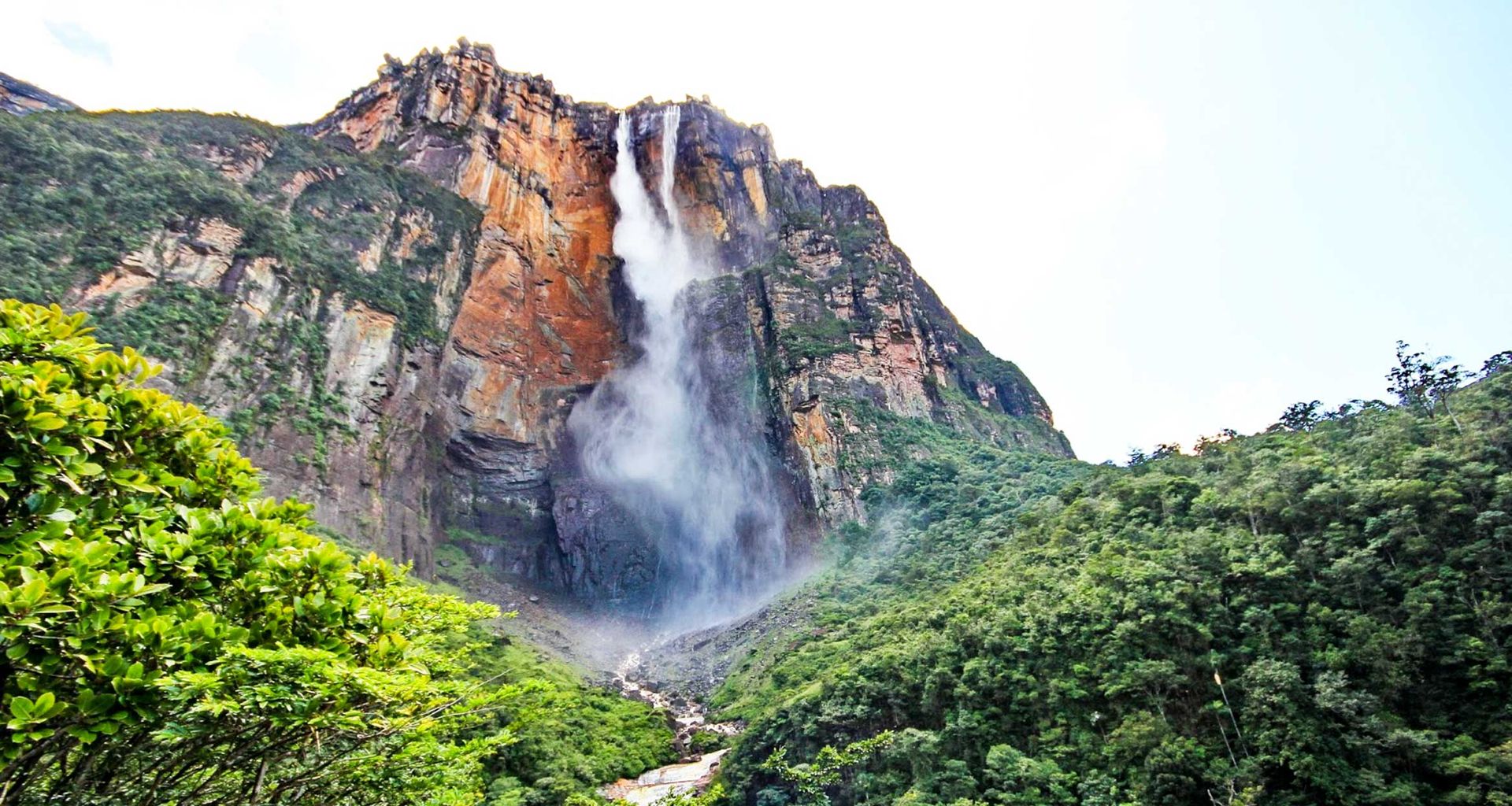
None of the stations used here sits at Angel Falls. The nearest Orinoco-lowland station, Ciudad Bolívar, shows a single wet season, with June to August at 6.3 to 7.2 inches (160–183 mm) a month (1961–1990 normals). In late March 2024, at the end of the dry season, photos of Angel Falls carrying noticeably less water circulated in Venezuela, and the Caracas newspaper El Diario put it down to the seasonal drought. The falls are part of our Highlights of Venezuela tour through Canaima National Park.
Margarita keeps its own calendar. Porlamar gets only 21 inches (527 mm) of rain a year, driest February to May, with April at 0.4 inches (10.5 mm). A Universidad de Oriente study of the island’s records found a dry half from January to June and moderate rain from July to December, picking up late in the year as Arctic cold fronts push south. February to June is also the windiest stretch.
Some years run wetter than the normals. INAMEH says La Niña tends to push Venezuela’s rainfall above normal, lower temperatures and raise the chance of tropical cyclones. The effect is weaker in the dry season than in the rainy season, when more than half the country feels it directly. If your dates fall in the rainy months of a La Niña year, leave some slack in the plan.
Light clothes cover most of Venezuela. Add a warm layer for Mérida’s evenings and anything higher, and rain gear for the Gran Sabana and the south in the rainy months. The rest is on our Venezuela packing list. If your trip continues into Colombia, our Colombia weather guide covers the neighboring country.
If Venezuela is on your list, conditions there change quickly. Read our Venezuela safety guide first, then talk to our travel experts about what is currently possible.